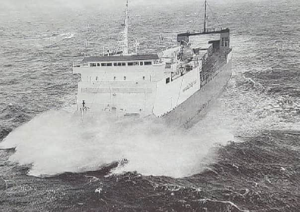
Nostalgia - From '˜La Manche' to '˜The Minch'


Yet the word is used every day by weather forecasters.
Thousands of people have passed over its waters and have never given it so much as a second thought except in bad weather.
In Gaelic, that stretch of water between Stornoway and Ullapool is known as Cuan Sgith, the tiring or wearisome sea, which describes exactly how a journey across the Minch has always been.
Advertisement
Hide AdAdvertisement
Hide AdYet the ‘Minch’ is not a Gaelic word. How about French and having a possible link with the 1745 Jacobite rising?
The maps and charts of the Outer Hebrides in the late 17th and 18th centuries use such general names as ‘The Occidental Ocean’ or ‘The Western Ocean’ for this stretch of water.
The earliest map which uses the Minch as a name is a Mercator map made from the surveys of an engineer called John Elphinston and is dated, significantly, 1745.
Here the word ‘Mynch’ is used. The map is dedicated to the Duke of Cumberland, equally significant.
Advertisement
Hide AdAdvertisement
Hide AdBut another map published in 1745 makes no mention of the word ‘Minch’, which suggests that the name had not been long in use.
Is there a chance that the name of the Minch has an association with the main character of the 1745 rising none other than Prince Charles Edward whose mother tongue was French?
So it might be the case that, having crossed the sea off the west of Scotland to land on the island of Eriskay in July 1745, he might have called that stretch of water ‘La Manche’, reflecting what the English Channel has always been named by the French.
Or, even a year later, when he crossed to South Uist from Skye, as a fugitive from the Government forces of the Hanoverian Crown.
Advertisement
Hide AdAdvertisement
Hide AdAnother question arises. If Prince Charlie had used the name ‘La Manche’, how could a few personal references get into so common a circulation that it appeared on a map dated 1745?
But if the survey on which the map was based included asking local people, particularly those in the Uists, what the stretch of water between Skye and South Uist was called, it may well have been that the word ‘La Manche’ had by that time passed into local circulation.
After all, it was a famous person who had called it that, but was then anglified into ‘Minch’.
In addition, the English officers who sailed up and down, and many times across, the Minch in search of the fugitive Prince, might well have come upon the new name and in the information sent to Cumberland passed on the name to be picked up by the contemporary chartmakers.
Advertisement
Hide AdAdvertisement
Hide AdIn maps dated 1782 and 1785 the Minch is placed between Harris and Skye.
Four years later, in 1789, a map appears which gives for the first time the distinctive names of ‘The Minsh’ and ‘The Little Minsh’ exactly in the positions they occupy in charts and maps of the present day.
We can only come to the conclusion that the ‘Minch’ name originated, in or around, the year 1745, but I am prepared to be wrong!
The turbulent nature of this stretch of water is derived from the tidal stream which flows from two directions.
Advertisement
Hide AdAdvertisement
Hide AdOne comes around the Butt of Lewis, the other passes the south end of the Western Isles to flow north up the Little Minch.
Both tidal streams meet at a line drawn roughly from Tiumpan Head and Rubha Coigeach 1n Sutherland.
The stream rate can be , anything from one to three miles an hour, which is the tidal rate as it rounds the Butt, increasing up to five miles an hour 1n the spring.
The tidal stream is easily affected by the wind and a strong northerly breeze will carry the stream from the little Minch further up the Minch before it meets the stream caning around the Butt.
Advertisement
Hide AdAdvertisement
Hide AdThis is one of the reasons why the Minch is seldom dead calm and why, today, many, people do not look forward to a jaunt across to Ullapool, even on a good day!
* This article, which appears in the next edition of Back in the Day out next week, was written by contributor Frank Thompson and was first published in 2004 in ‘The Hebridean’ publication.