Don’t be expecting a white Christmas - this is just a blip


They have also warned of the possibility for icy stretches likely to bring some travel disruption on Wednesday night into Thursday morning as the temperatures dip overnight.
We don’t think there’s any real rush to be looking out your sledges, just yet!
Advertisement
Hide AdAdvertisement
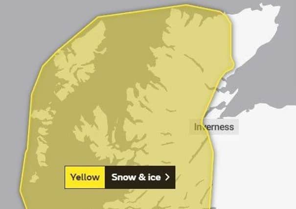
Hide AdThe advisory reads: Frequent showers will increasingly turn to snow Wednesday night and persist into Thursday morning though these are likely to fall as sleet and hail at times, mainly around coasts.
Northwest Scotland looks most exposed to these showers with 2cm of snow accumulating by Thursday morning in places even to low levels.
Larger accumulations are expected at higher elevations with 2-5cm above 200m and up to 10cm over some of the higher elevation routes.